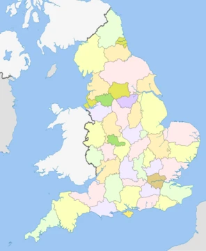
Cambridgeshire
A low-lying English county with Neolithic sites and historic universities.
Cambridgeshire (often shortened to Cambs.) is a ceremonial county located in the East of England, within the region of East Anglia. Its neighbours are Lincolnshire to the north, Norfolk to the north-east, Suffolk to the east, Essex and Hertfordshire to the south, Northamptonshire to the west, and Bedfordshire to the south-west. The largest settlement is the city of Peterborough.
Covering 3,389 square kilometres (1,309 square miles), the county had an estimated population of 906,814 in 2022. Peterborough lies in the north-west, while the city of Cambridge is in the south. The rest of the county is rural, featuring the city of Ely in the east, Wisbech in the north-east, and St Neots and Huntingdon in the west. For local government, Cambridgeshire consists of a non-metropolitan county with five districts, plus the unitary authority of Peterborough; these bodies cooperate through the Cambridgeshire and Peterborough Combined Authority. Historically, the county did not include Huntingdonshire or the Soke of Peterborough (the latter was part of Northamptonshire).
The north and east are dominated by the Fens—an extremely flat, drained marshland kept dry by ditches and dykes. Holme Fen is the UK’s lowest natural point, sitting 2.75 metres (9 feet) below sea level. This flatness makes any higher ground, such as the hill Ely is built on, stand out sharply. The south and west have gently rolling terrain. The main rivers are the Nene, which flows through the north and is canalised east of Peterborough; the Great Ouse, running west to east past Huntingdon and Ely; and the Cam, a tributary of the Great Ouse that flows through Cambridge.
**History**
Cambridgeshire is home to Flag Fen in Fengate, one of the earliest-known permanent Neolithic settlements in the UK, considered as significant as Balbridie in Aberdeen, Scotland. The Must Farm quarry at Whittlesey has been called "Britain's Pompeii" because of its exceptional preservation, including the best-preserved Bronze Age dwellings ever found in the country. A wealth of Stone Age, Bronze Age, and Iron Age artefacts has been uncovered in East Cambridgeshire, with most finds coming from Isleham.
Anglo-Saxon settlement began in the fifth century. Genetic testing of seven skeletons from Anglo-Saxon graves at Hinxton and Oakington showed that five were migrants or descended from continental migrants, one was a native Brito
- Area
- 3,389 km² (1,309 sq mi)
- Estimated population (2022)
- 906,814
- Lowest physical point
- Holme Fen, 2.75 m (9 ft) below sea level
- Highest point (modern administrative cou
- Great Chishill, 146 m (480 ft) above sea level
- Largest settlement
- Peterborough
- County flower (unofficial)
- Pasqueflower (designated 2002)
Lore & Background
Cambridgeshire was recorded in the Domesday Book as 'Grantbridgeshire' (Grentebriġesċīre). The area was settled by Anglo-Saxons starting in the fifth century; genetic testing on seven skeletons from Anglo-Saxon era graves in Hinxton and Oakington found that five were migrants or descended from migrants from the continent, one was a native Briton, and one had mixed ancestry. The county's modern boundaries result from several local government unifications: in 1965 the administrative counties of Cambridgeshire and the Isle of Ely merged to form Cambridgeshire and the Isle of Ely; under the Local Government Act 1972 this merged with Huntingdon and Peterborough to form the current county. Since 1998, Peterborough has been a unitary authority, associated with Cambridgeshire for ceremonial purposes.
Reader's Guide
Cambridgeshire's significance lies in its archaeological heritage, its role in early Anglo-Saxon settlement, and its modern economic and educational prominence. The county contains Flag Fen, one of the earliest-known Neolithic permanent settlements in the UK, and Must Farm quarry, which yielded the best-preserved Bronze Age dwellings ever found in the UK. During the Second World War, its flat terrain led to the construction of many airfields for RAF Bomber Command, RAF Fighter Command, and the USAAF, commemorated by the Cambridge American Cemetery and Memorial at Madingley. Today, Cambridgeshire is home to the University of Cambridge, one of the most prestigious academic institutions in the world, and the Silicon Fen area of high-technology companies. The county's economy remains largely agricultural, with the inland Port of Wisbech as its only remaining port. The Cambridgeshire Regiment (nicknamed the Fen Tigers) served in the Boer War and both World Wars. The county's flag, adopted in 2014, features three golden crowns representing East Anglia and two wavy lines representing the River Cam in Cambridge University's colours.
Did You Know?
- Holme Fen is the UK's lowest physical point, at 2.75 m (9 ft) below sea level.
- The county's historical nicknames include 'Cambridgeshire Camel' and 'Cambridgeshire Crane'.
- Must Farm quarry at Whittlesey has been described as 'Britain's Pompeii' due to its well-preserved Bronze Age dwellings.
- The county flower, the Pasqueflower, was unofficially designated in 2002 by the conservation charity Plantlife.
More in English Counties 25-39
Elsewhere in the English Counties universe
Spotted an error? Know more?
This is a living reference — every entry is fact-audited, and reader corrections feed straight into our audit queue. Suggest an edit · See this site's audit record