Bedfordshire
Ceremonial county in the East of England with varied geography.
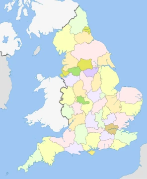
Bedfordshire (often shortened to Beds) is a ceremonial county located in the East of England. It shares borders with Northamptonshire to the north, Cambridgeshire to the north-east, Hertfordshire to the south-east and south, and Buckinghamshire to the west. The county’s most populous settlement is Luton. Covering an area of 1,235 square kilometres (477 square miles), Bedfordshire had an estimated population of 749,943 in 2024. For local administration, the county is split into three unitary authorities: Bedford, Central Bedfordshire, and Luton.
The landscape of Bedfordshire is varied. The centre consists of a gently undulating clay plateau, from which a ridge of greensand rises, running from south-west to north-east with a distinct north-facing escarpment. In the south, around Luton, part of the chalk Chiltern Hills is found, while the north contains a section of a limestone ridge stretching between Milton Keynes and Northampton. The county’s highest point, at 243 metres (797 feet), is on the Dunstable Downs, part of the Chilterns. The River Great Ouse flows through Bedfordshire, entering upstream of Harrold in the north-east, winding southwards to Bedford, then turning north-east to exit the county upstream of St Neots in Cambridgeshire.
The name “Bedfordshire” was first recorded in 1011 as “Bedanfordscir,” meaning the shire of Bedford, which itself derives from “Beda’s ford” (a river crossing). Historically, the county was divided into nine hundreds: Barford, Biggleswade, Clifton, Flitt, Manshead, Redbornestoke, Stodden, Willey, and Wixamtree, along with the liberty and ancient borough of Bedford. The county boundary has changed over time; for instance, in 1897, Kensworth and part of Caddington were transferred from Hertfordshire to Bedfordshire.
Geologically, most of Bedfordshire’s rocks are clays and sandstones from the Jurassic and Cretaceous periods, with some limestone. Local clay has been used to make Fletton-style bricks in the Marston Vale. Glacial erosion of chalk has left hard flint nodules deposited as gravel, which were commercially extracted in the past, creating pits that are now lakes at Priory Country Park, Wyboston, and Felmersham. The Greensand Ridge is an escarpment crossing the county from near Leighton Buzzard to near Gamlingay in Cambridgeshire.
Bedfordshire has a relatively dry climate for the UK, with regular but generally moder
- Area
- 1,235 km2 (477 sq mi)
- Population (2024 est.)
- 749,943
- Largest settlement
- Luton
- Highest point
- 243 m (797 ft) on Dunstable Downs
- County town
- Bedford
- First recorded name
- Bedanfordscir (1011)
Lore & Background
The first recorded use of the name in 1011 was 'Bedanfordscir', meaning the shire or county of Bedford, which itself means 'Beda's ford' (river crossing). Bedfordshire was historically divided into nine hundreds: Barford, Biggleswade, Clifton, Flitt, Manshead, Redbornestoke, Stodden, Willey, Wixamtree, along with the liberty and the ancient borough of Bedford. There have been several changes to the county boundary; for example, in 1897 Kensworth and part of Caddington were transferred from Hertfordshire to Bedfordshire.
The centre of Bedfordshire is a gently undulating clay plateau, out of which rises a ridge of greensand that runs south-west to north-east and which has a distinct north-facing escarpment. The south of the county, around Luton, contains part of the chalk Chiltern Hills, and the north of the county part of a limestone ridge that runs between Milton Keynes and Northampton. The county's highest point is at 243 m (797 ft) on the Dunstable Downs, which are part of the Chilterns. The River Great Ouse flows through Bedfordshire, entering upstream of Harrold in the north-east and flowing in a circuitous but broadly southerly route to Bedford before turning north-east to exit the county upstream of St Neots in Cambridgeshire.
Reader's Guide
Bedfordshire's significance lies in its position as a transport corridor linking London to the Midlands and Northern England, with major roads (A1, A5, M1) and three main railway lines (West Coast, East Coast, Midland Main Line) passing through. Luton Airport, the fifth busiest in the United Kingdom, provides international connectivity. The county's economy includes headquarters or major bases of companies such as EasyJet, Vauxhall Motors, and Costa Coffee. Culturally, the Bedfordshire clanger—a suet crust pastry filled with meat at one end and fruit preserve at the other—is a traditional local dish. The county's climate is relatively dry for the UK, with an average annual rainfall of 608.6 mm at Bedford, and it experiences one of the largest absolute temperature ranges in the UK, exceeding 60 °C. The highest official temperature recorded was 39.7 °C in 2022, and the lowest was −20.6 °C in 1947. For local government, Bedfordshire is divided into three unitary authorities: Bedford, Central Bedfordshire, and Luton, while policing and fire services remain county-wide.
Did You Know?
- The first recorded use of the name 'Bedanfordscir' was in 1011.
- The county's highest point is 243 m (797 ft) on the Dunstable Downs.
- The Bedfordshire clanger is a local dish with meat in one end and fruit preserve in the other.
- Luton Airport is the fifth busiest airport in the United Kingdom.
More in English Counties 25-39
Elsewhere in the English Counties universe
Spotted an error? Know more?
This is a living reference — every entry is fact-audited, and reader corrections feed straight into our audit queue. Suggest an edit · See this site's audit record